
The graffiti on the bridge in front of us is colorful but not exactly the cultural experience I was hoping to give my kids. We’ve been cruising the streets on the edge of Macon, Georgia, looking for a collection of Native American mounds, but so far all we’ve found is liquor stores and some randy messages spray-painted on an overpass. We are lost.
It’s an odd feeling and an increasingly uncommon one; given the GPS devices in our pockets, it’s pretty damn hard to make a wrong turn. Unless, that is, you decide to ditch the GPS entirely and let your two 12-year-olds choose the route for the family road trip using an old-school atlas.
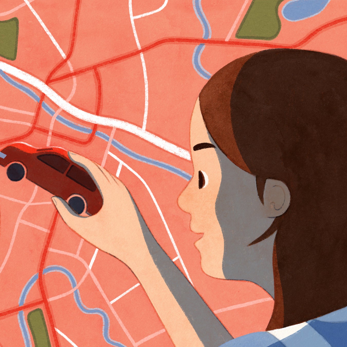
A week before we arrived in Macon, I bought a Rand McNally and told my kids they would navigate our spring-break journey. We’d be traveling from our home in Atlanta to Hunting Island State Park, a barrier island six hours and 300 miles southeast on the coast of South Carolina, where we’d spend a few days camping and paddleboarding. I set the atlas in front of them on the kitchen table and explained what it was. Then I circled our starting point and destination on the map and asked them to plot our course. I may as well have given them an abacus and asked them to do algebra. It didn’t help that they can barely agree on the color of the sky.
Call this an experiment in GPS detox. I’m as guilty as anyone when it comes to relying too heavily on my devices to tell me where to go. I subscribe to Gaia GPS and OnX and use my phone to find Chinese food when I’m hungry; I always know where I am in the woods and the location of the nearest egg roll. But I don’t really know how to get anywhere on my own anymore. I just drift through the landscape on autopilot, turning wherever the nice lady in my phone tells me to turn. As a result, I’ve lost my sense of place, and I’m oblivious to the landscape around me. “You can feel completely disconnected and lost in space using GPS,” says Dave Imus, a cartographer who creates maps that focus on the ridges, valleys, and rivers that define a region instead of its town names and interstate exits.
If it’s gotten this bad for me, I’m even more worried about my kids, Cooper and Addisson, who could grow up without ever using a paper map—which feels like bad parenting on my part. Hence the spring-break road-trip experiment. “Please don’t turn our beach vacation into a lesson,” my daughter pleaded. She might be sassy, but she’s not wrong. The beach trip is totally going to be a lesson.
First we have to get out of Atlanta, which on the map looks like a snake’s nest of highways. The blue circle of an interstate wraps around the whole city, so in theory, you could take a wrong turn and do laps until you run out of gas. But my son figures out that I-75 cuts through Atlanta, so if we keep heading south, we’ll eventually get past the mayhem.
I thought we’d fumble around a series of back roads until we ran out of gas or I started crying, but instead we actually all had fun.
The kids pore over the atlas in the back seat, getting a kick out of finding town names that are dangerously close to being dirty words, like Bullocks and Blichton. They also think it’s cool that the border of Georgia and South Carolina is defined by the Savannah River, not just some arbitrary line drawn in the sand, and that the coast of both states is painted with a lot of green because of an abundance of wildlife refuges there.
Middle Georgia is mostly flat, hot, and full of pecan trees. But I’m determined to give the kids a sense of the landscape we’re traveling through, so I ask them to look for cool detours, like patches of green or blue on the map indicating parks or rivers and lakes. They trace I-75 through the state and contemplate different places we could check out—Oconee National Forest, High Falls State Park—but settle on Ocmulgee Mounds National Historic Park, a collection of Native American earth mounds just outside Macon.
Navigating the surface roads to the park doesn’t go smoothly. I lose count of the number of U-turns I make, and we end up sitting in the parking lot of a sketchy liquor store while the kids argue. But I refuse to pull out my phone. If we drive into a river, it’s going to be at the hands of my children. Eventually, they guide us to the park, which is worth the trouble. We walk to the top of the Great Temple Mound, a ceremonial 55-foot-tall clay hump that archeologists estimate took ten million baskets of dirt to create. It’s the highlight of the road trip.
A couple of hours later (call it two and a half, due to some confusion around which direction we should go off the exit), we make it to the coast. There’s not enough detail on the atlas for the kids to comprehend the sheer volume of islands that litter the edge of South Carolina, so we use one of those cartoonish tourist maps of the area to navigate our way across a string of inlets and islets to Hunting Island State Park. Once we arrive at our campsite, the kids take advantage of their newfound navigational power and use the map to direct us to ice cream shops and a waterfront park with big oaks covered in Spanish moss.
I’m not gonna lie and say we took the most efficient route. We didn’t. But my kids got us to the beach. I thought we’d fumble around a series of back roads until we ran out of gas or I started crying, but instead we actually all had fun.
A good lesson never ends, so now that we’re back home, I keep quizzing them on directions. I’ll pull over into a random parking lot and ask them how to get to our house. I’ll bring out the atlas and have them look for cool parks we should explore. I ask them where a certain river eventually leads to and which direction we should walk to reach a ridge of mountains on the horizon. They get annoyed with me, because they’re 12, but they’re learning their way around their corner of the world.